Mount Pelée (1,397 m / 4,583 ft) is the highest point of Martinique and an active volcano in the north of the island. Its eruption of 8 May 1902 destroyed the city of Saint-Pierre and remains the deadliest volcanic disaster of the 20th century. Today the volcano is closely monitored (alert level: yellow, "vigilance", as of October 2026) and the hike to the summit is one of the island's most popular.
Pelée is the third-highest summit of the Lesser Antilles, after Guadeloupe's La Grande Soufrière (1,467 m) and Dominica's Morne Diablotins (1,447 m). The Martinique volcano and seismology observatory (OVSM-IPGP) monitors it permanently and publishes a weekly public bulletin.

Discover 97 Authentic Activities to Explore in Martinique!
Unforgettable adventures await you - whether with family, as a couple, with friends, or for unusual discoveries. Find the perfect activity for every moment!
Easy and Secure Booking
Discovering Mount Pelee
Mount Pelée (1,397 m / 4,583 ft) is the highest point of Martinique and an active volcano in the north of the island. Its eruption of 8 May 1902 destroyed the city of Saint-Pierre and remains the deadliest volcanic disaster of the 20th century. Today the volcano is closely monitored (alert level: yellow, "vigilance", as of October 2026) and the hike to the summit is one of the island's most popular.
Pelée is the third-highest summit of the Lesser Antilles, after Guadeloupe's La Grande Soufrière (1,467 m) and Dominica's Morne Diablotins (1,447 m). The Martinique volcano and seismology observatory (OVSM-IPGP) monitors it permanently and publishes a weekly public bulletin.
It provides some spectacular hiking trails with excellent views for nature-lovers.
A climb up the mountain is a must for visitors to the area, and there are many paths of varying difficulty:
- Aileron (from Le Morne-Rouge, about 820 m): the most popular, about 4 to 6 hours round trip;
- Grande Savane (from Le Prêcheur, about 650 m): steeper and less crowded, about 4 hours round trip;
- Grand'Rivière (via Habitation Beauséjour) and Macouba (via Désiles): very long and demanding, about 9 hours round trip, for experienced hikers only.
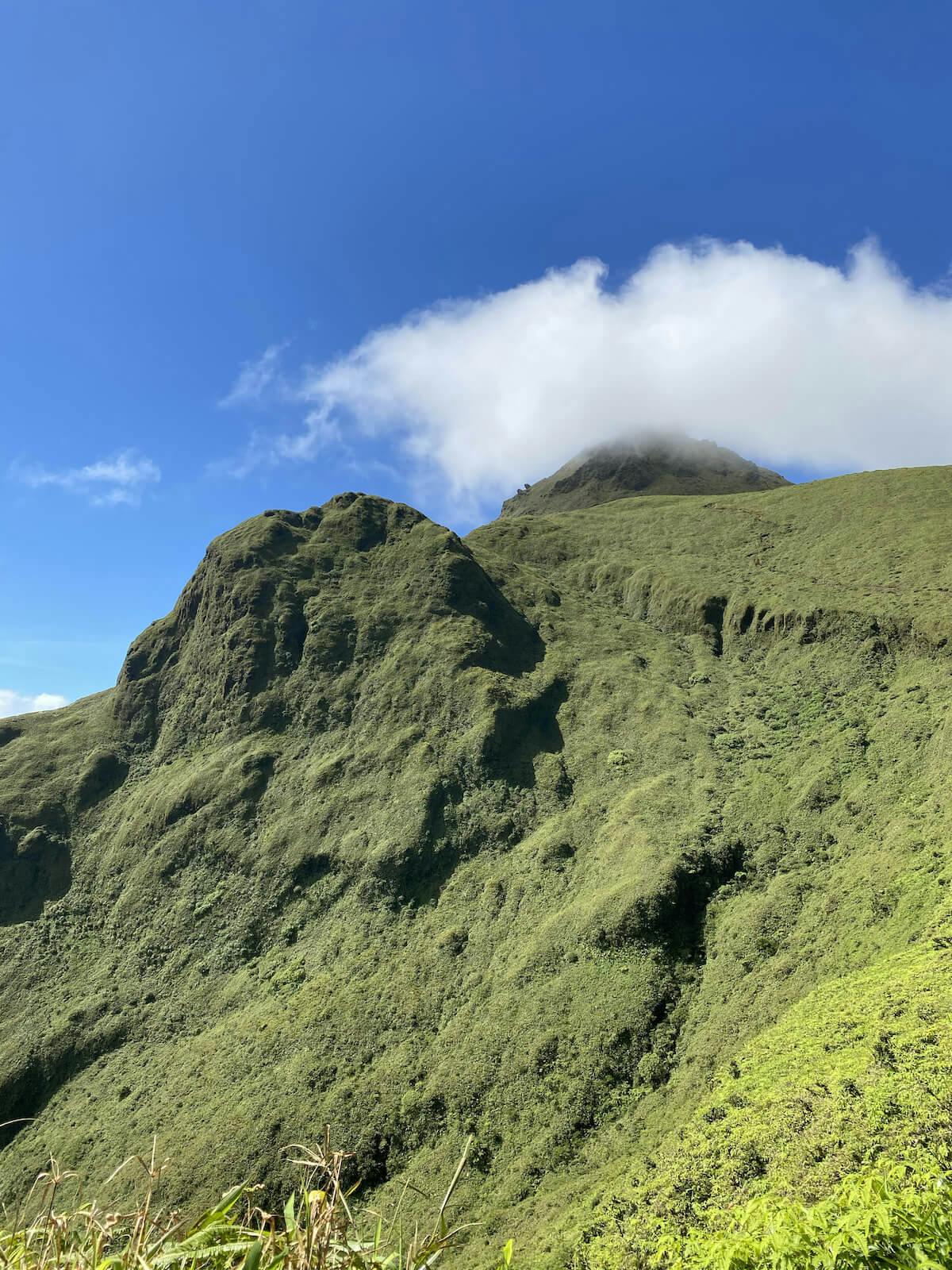
Whichever path you choose, pick a fine morning to climb the slopes of the volcano and of course don't forget to bring plenty of water, a hat, rain gear and a jumper with you. Although the Pelée mountain is unfortunately often shrouded in clouds, hindering the area's visibility, it offers outstanding views over Martinique and the sea on a clear day. Nature lovers will be enthralled by the awe-inspiring scenery! If you prefer to go with a guide, see the guided ascent of Mount Pelée, and for more trails read our guide to the best hikes in Martinique.
Mount Pelée (1,397 m / 4,583 ft) is the highest point of Martinique. It is an active volcano, closely watched by the observatory, and its eruption of 1902 is the deadliest of the 20th century.
History of Mount Pelée
Mount Pelée erupted on 8 May 1902, killing between 28,000 and 30,000 people in and around Saint-Pierre. It is the deadliest volcanic eruption of the 20th century. In the 1800s, volcanology was in its initial stages, and the earlier volcanic stirrings of the 19th century were deemed to be of no significance. In the weeks before the eruption, sulphurous fumes, ash falls and explosions were reported around the mountain.
In early May the volcano grew more and more restless. People from the surrounding countryside took refuge in Saint-Pierre to escape the ash and debris, and a local newspaper told residents there was no real risk.
Shortly before 8 a.m. on 8 May, Ascension Day, a glowing cloud of hot gas and ash (a pyroclastic flow, or "nuée ardente") swept down the volcano at several hundred kilometres per hour and destroyed Saint-Pierre in about two minutes. Governor Louis Mouttet and his wife were among the dead.
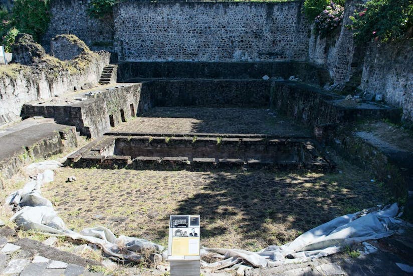
The city burned for several days and almost every ship in the bay was lost. Only a handful of people survived in the destroyed zone. The best known is Louis-Auguste Cyparis (also called Ludger Sylbaris), a prisoner protected by the thick walls of his cell, which you can still see in Saint-Pierre. The shoemaker Léon Compère-Léandre also survived, badly burned. A British ship, with her crew all severely burned, managed to coast back to St. Lucia.
The volcano stayed violent for months: on 30 August 1902 a second deadly eruption killed about 1,000 more people, mostly in Morne-Rouge. A spectacular lava spine then grew above the crater between late 1902 and 1903, reaching about 310 m before collapsing.
Pelée erupted again from September 1929 to 1932. This time the danger zone was evacuated and nobody died. This eruption built the 1929 dome, whose top, Le Chinois, is the summit of the mountain. Since September 2023, the volcanoes and forests of Mount Pelée and the northern Pitons are a UNESCO World Heritage Site.
Route to Mount Pelée
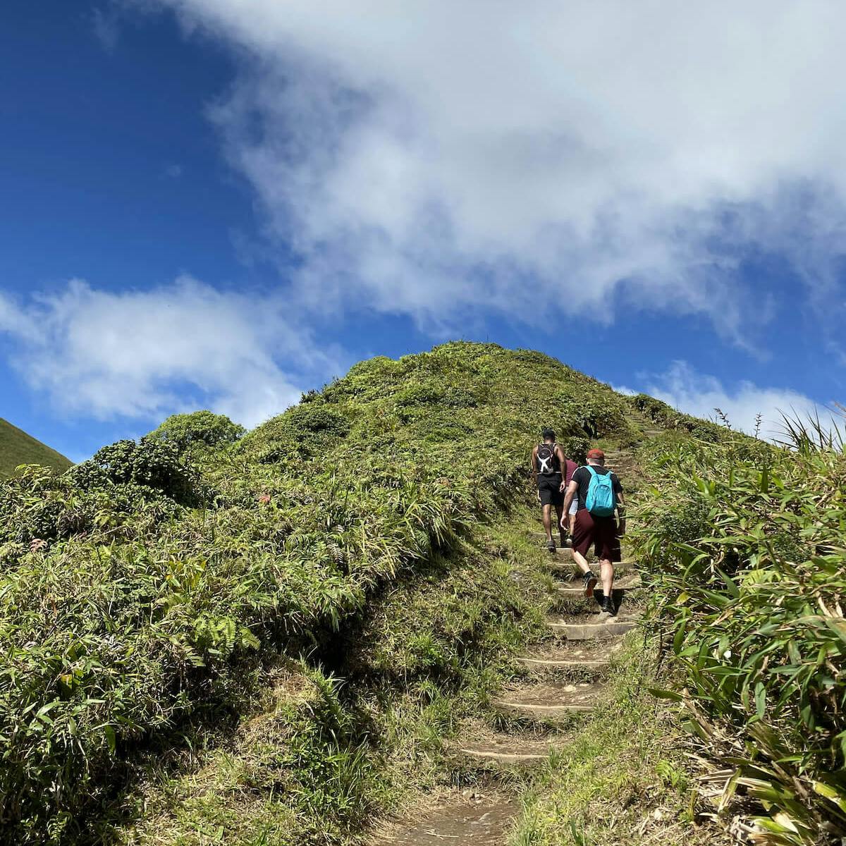
The most popular route, the Aileron trail, starts from a car park at about 820 m (2,700 ft) just north of Le Morne-Rouge. Allow 4 to 6 hours for the round trip. The path is a mix of steps, rocks, roots and mud that the ONF (French forestry office) repairs regularly, and the last stretch to the summit involves scrambling over rocks.
Both the 1902 and 1929 domes sit within the crater and are made mostly of andesite blocks, now partly covered with vegetation. The peak is the top of the 1929 dome. There have been no fumaroles (steam or sulphur) at the summit since 1970, but the observatory has measured a slow swelling of the summit area since 2025, which is why Pelée is on yellow alert.
Is Mount Pelée dangerous? Current alert level
Since 4 December 2020, Mount Pelée has been on yellow alert ("vigilance"), the second level of a four-level scale, after volcanic earthquakes increased from April 2019. It does not mean an eruption is imminent. In its recent weekly bulletins, the observatory recorded small volcanic earthquakes, none felt by the population, and slow ground swelling near the summit. It states that the probability of eruptive activity in the short term remains low, but that an evolution over the coming weeks to months cannot be ruled out. At the time of writing (October 2026) we found no official closure of the main trails, but access can change quickly: check the latest OVSM bulletin on ipgp.fr and ask the ONF or the Morne-Rouge town hall before you go.
The ascent by the Aileron trail
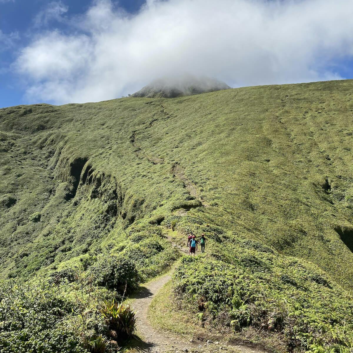
The Aileron trail is the most used, because it is the shortest and the easiest of the summit routes. It is a rather classic hike from a difficulty point of view, but the last stretch involves scrambling over rocks. Allow 4 to 6 hours of walking for the round trip, with about 600 m of climbing. The departure is from the Aileron car park at about 820 meters of altitude; to reach it you have to drive 2 km after Le Morne Rouge, towards Ajoupa-Bouillon, and then take the road of Aileron to the car park.
The first step of the walk is the dome of Aileron, then the plateau of Palmistes and finally the site of the Caldeira. We advise you to admire the sunrise from the Palmistes plateau and then continue to the summit accompanied by the first light of the day. The end of the hike is at Le Chinois, on the dome formed in 1929, the summit of the mountain (about 1,397 m). At the summit, there is not one but two interlocking domes that follow the different eruptions.
The ascent by the Grande Savane trail
The ascent by Grande Savane is less frequented, longer, but surely more interesting for the regulars. The departure is at the end of the road that leads to Grande Savane, above the village of Prêcheur at 650 m of altitude. The hike starts in the jungle and overlooks the Caribbean Sea all the way up.
It will take you about 4 hours of round trip walking to complete this trail. Upon arrival at the Caldera, you will enjoy a beautiful view of Saint-Pierre. In addition, you will be able to reach the 3rd refuge and also finish at Le Chinois, before heading back down quietly.
The ascent by the Grand'Rivière trail
The Grand'Rivière trail is the most technically difficult. There are two possible starting points. For the first option, you must reach the Habitation Beauséjour located in the commune of Grand'Rivière. This hike lasts about 9 hours round trip and is for experienced hikers only. Some passages are quite rough, but the landscapes are worth it. You will take small paths in the middle of sugar cane and banana plantations.
It is of course possible to continue to Le Chinois. The second option leaves from the village of Macouba and joins the first trail at the Savane Anatole. It is also a very long day, of about 9 hours of walking.
Bonus: an additional walk
Another fascinating walk on the SW side of the volcano is up La Coulée Blanche, which begins about 1 km beyond St. Pierre.
In 1902 and 1929, pyroclastic surge crushed this valley and the cliffs became whiter than the natural pumice. You can also bathe in the water until you hit a plunge.
Saint-Pierre
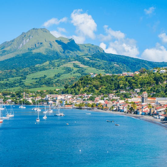
After your Mount Pelée adventure, why not visit Saint-Pierre, whose history is intimately linked to the activity of the volcano? If you are interested in history, visiting Saint-Pierre is a very moving experience. Saint-Pierre, classified as a city of art and history, has risen from its ashes and now relies heavily on tourism to help it recover. After the disaster of 1902, the Martinicans, attached to their land, have done everything to rebuild the city and the town now has about 4,000 inhabitants.
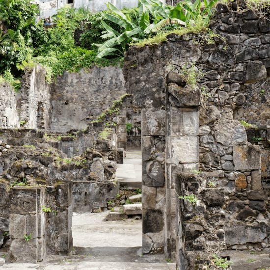
You can still see the remains of the Fort church, the old theater, the Cyparis dungeon and much more. The Mémorial de la catastrophe de 1902 (the former Frank A. Perret museum, founded in 1933) tells the story of the eruption: check opening hours and prices before you go. For a guided visit, see the walk rich in history in Saint-Pierre, the ancient capital. So, are you ready for the adventure?
Will you give the Pelée Mountain a try ? :)
Mount Pelée can be viewed from almost everywhere on the island and can also be climbed. It's entirely possible to go trekking to explore the flora and fauna, and to enjoy the view from the heights. Three main marked routes lead to the summit (Aileron, Grande Savane and Grand'Rivière), but to fully enjoy them, it is recommended that you are in good physical shape, as in certain cases the trails can be deceptive. To reach the trailheads, consider renting a car in Martinique.
Whatever your reason for visiting the beautiful island of Martinique, this place is well worth a trip. So, take a break and explore this mesmerizing, amazing, historically and culturally rich place.
However, if you are still undecided, these 10 reasons to visit Martinique will definitely convince you!
Frequently asked questions about Mount Pelée
Yes, it is an active volcano under permanent watch, on yellow alert (vigilance) since December 2020. The observatory says the short-term probability of an eruption remains low. Check the latest OVSM bulletin and trail status with the ONF before you go.
The Aileron trail takes about 4 to 6 hours round trip, with about 600 m of climbing. Start early, because clouds often cover the summit from about 10 a.m., and bring water and a rain jacket.
1,397 m (4,583 ft), the highest point of Martinique and the third-highest summit of the Lesser Antilles. The summit, Le Chinois, sits on the dome formed in 1929.
Between 28,000 and 30,000 people died on 8 May 1902, mostly in Saint-Pierre. Only a handful survived in the destroyed zone, the best known being the prisoner Louis-Auguste Cyparis.
Discover 97 Authentic Activities to Explore in Martinique!
Unforgettable adventures await you - whether with family, as a couple, with friends, or for unusual discoveries. Find the perfect activity for every moment!
Easy and Secure Booking